
Launch of ULPIN in Assam: Unique ID for land parcels for modern land governance
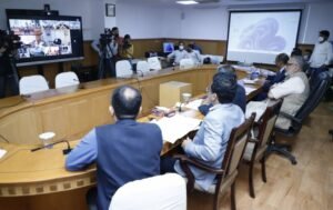
Guwahati, March: The Unique Land Parcel Identification Number (ULPIN) conceptualized under the MMP – Digital India Land Records Modernization Programme of Department of Land Resources, was launched for Assam through virtual mode in presence of Hon‘ble Union Minister of Rural Development & Panchayati Raj Shri Giriraj Singh; Minister of State for Rural Development Smti Sadhvi Niranjan Jyoti; Minister of State for Panchayati Raj Shri Kapil Moreshwar Patil;, Minister of State for Rural Development and Steel Shri Faggan Singh Kulaste; Secretary, Department of Land Resources Shri Ajay Tirkey, IAS; Additional Secretary, Department of Land Resources Shri Hukum Singh Meena, IAS; Joint Secretary, Department of Land Resources Shri Sonmani Borah, IAS; Principal Secretary, Revenue and D.M. Department, Govt. of Assam Shri Avinash Joshi, IAS; Director of Land Records and Surveys,‘Assam, Shri Gyanendra Dev Tripathi, IAS; senior most officers of Central and State Governments, Deputy Commissioners and district officials. The initiative plans to issue a 14–digit alpha numeric geo spatial unique identification number, which can be touted as Bhu – AADHAR for every land parcel of the state.
Shri Giriraj Singh, Union Minister of Rural Development & Panchayati Raj addressing the State Ministers and senior officials called upon all to learn and adopt the best practices in the field of land management, land acquisition and appreciated the foundational land governance work being done in the states. Talking about the importance of ULPIN, Shri Singh said when this system will be implemented in the true spirit most of the land disputes will be resolved.
Shri Jogen Mohan, Minister, Revenue and Disaster Management Department informed that to integrate all processes around land records database, the state government has initiated a consolidated effort under the flagship Mission Basundhara. Along with mission mode purification of land records, the initiative envisages that with the survey of non–cadastral villages and re–survey of all cadastral villages; after the end–to–end integration of digitalized land records and maps, ULPIN will be generated for the real time accurate land parcels. As the geospatial identifier complies with international standards, it will pave the way towards implementation of conclusive titling.
In Assam, ULPIN generated at present for 434 villages of Srijangram, Boitamari and Bongaigaon Circles of Bongaigaon district as pilot with Property Natural Identifier Unit generated for 168753 land parcels.